


Family hike and swim at Daisy Hill Conservation Park
- B-Line Bruce Hiscock
- Feb 9, 2018
- 3 min read

Activity Description
Half to full day family hike and picnic, with a swim in the Old Quarry
Location
Daisy Hill Conservation Park is 25km south-east of Brisbane or 50km north of the Gold Coast via the Pacific Motorway (M1)
Park features
Take the family for a cycle, hike or horse ride along the shared trails in the park.
Daisy Hill Conservation Park protecting 571ha of open eucalypt forest in the southern suburbs of Brisbane, this park provides significant habitat for koalas and other wildlife, and features the Daisy Hill Koala Centre. The Daisy Hill picnic area and the Daisy Hill trail hub provide picnic and barbecue facilities with two undercover seating areas. Signposted walking tracks begin at various points along the edge of the picnic area. The Daisy Hill trail hub provides opportunities for mountain-bike riding and horse riding on the park’s shared trail network. https://www.npsr.qld.gov.au/parks/daisy-hill/
Daisy Hill Conservation Park is an important part of one of Australia’s most significant regional koala populations. Daisy Hill Koala Centre offers the opportunity to see koalas up close and learn about protecting these unique animals and their habitat. Interactive displays are a feature of the centre.
The surrounding forest is home to a population of koalas, providing great opportunities for spotting koalas in the trees throughout the picnic area and along walking tracks.
For more information and printable maps follow the link: https://www.npsr.qld.gov.au/parks/daisy-hill/
Story time
Arriving just after lunch time and parking the car at the top carpark, or Daisy Hill trail hub, we headed out along the multi-use trail of Quarry Road (this is a main connecting trail in the park, take care with mountain bikers and horse riders on this trail), following this wide trail for the majority of the trek. It was sporadically raining, making it fresh, but it was lucky we had umbrellas.
The main trail forms a part of the Stringybark and Buhot Creek circuits. It will also pass into the connected Neville Lawrie Reserve at Bishops Break.
We passed the following trails in order and side: Lace Monitor Trail on the left, Dennis Break on the right, Puttenaea Track on the left, Whoa Boy Break, Kimberley Link and Charcoal Break on the right, Lace Monitor Trail on the left again, Buhot Creek Break on the left, Glossy Black Trail on the left, Barking Dog Break on the left, Stringybark Break on the left, Bishops Break on the left (just after crossing the gate).
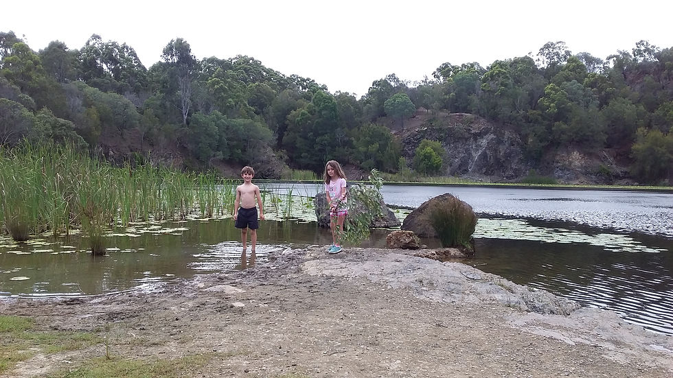
We then turned left at the very next trail after Bishops Break (this trail has no name, but it is sign posted at the intersection with the Old Quarry, so you will know you are headed in the right direction). Then the Old Quarry is on the right off this unnamed trail. WE ARRIVED!
After arriving we went for a refreshing swim, and had fun jumping off the rock ledge into the what is now the lake that has formed out of the Old Quarry. The water was very clear and refreshing.
After our swim we had a wonderful picnic of sandwiches and fruit before returning.
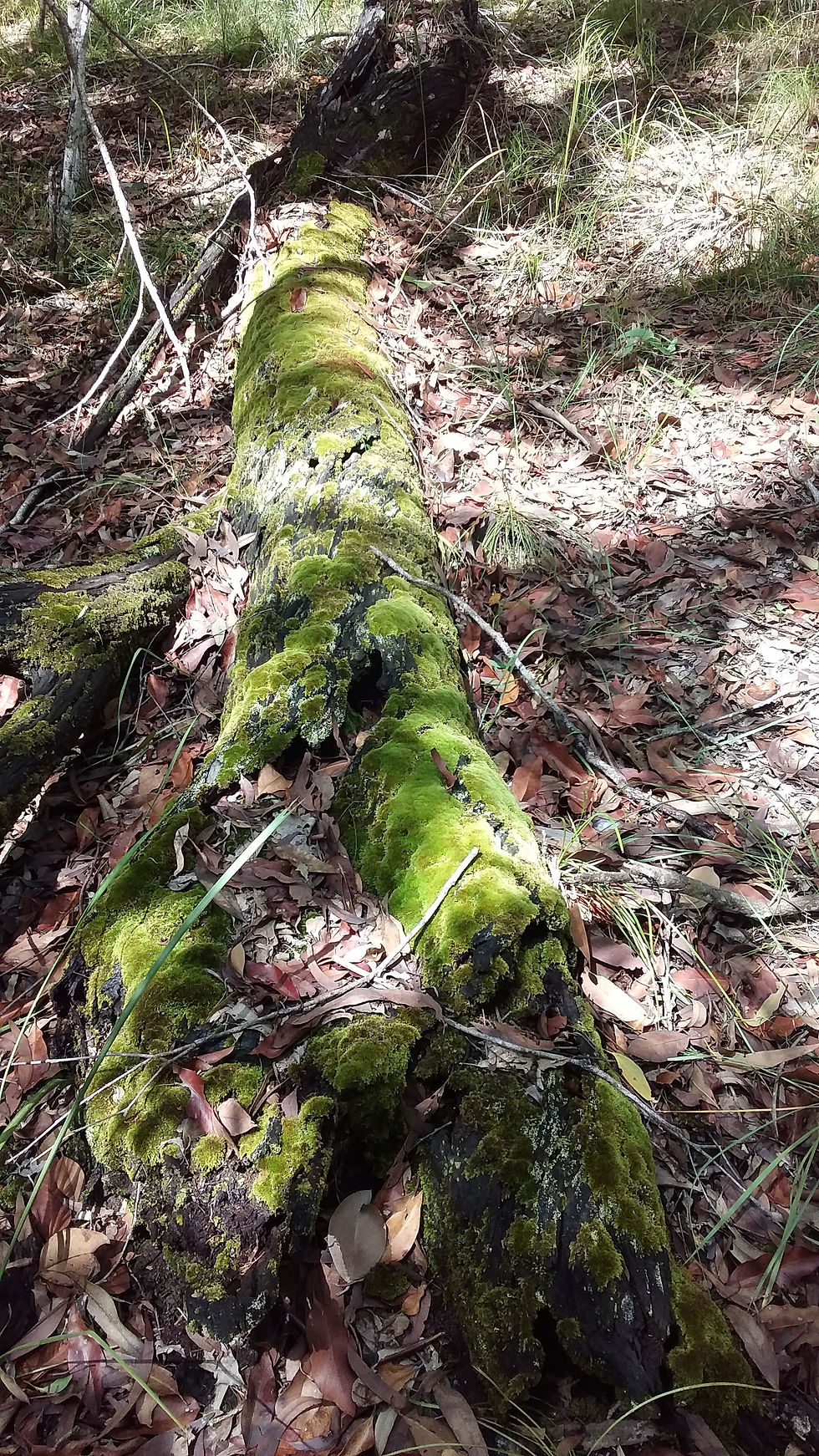
On the return trip we decided to walk along the Glider trail, where we found the photo of the moss-covered tree (this is a shared thin singletrack trail, so take care with mountain bikers and horse riders along this trail. I know this trail is popular with the mountain bikers. Take note to the give-way code on shared trails).
On the exit of the Glider Trail we turned left and headed along Bishops Break, then turned right back onto the Quarry Road Trail. Back to the trail hub.


Comments