


BAYVIEW BLAST MTB Ride
- B-Line Bruce Hiscock
- Feb 11, 2018
- 5 min read

Updated: Feb 16, 2018
Activity Description
Mountain Biking
Location
Bayview Conservation Area
Getting There
Enter the Bayview Conservation Area at the following locations:
Main entry and day use area, 487-503 German Church Road - Park in the areas inside or outside of the reserve at its north-west entry point.
Days Road entry - Park at the end of Days Road along the north-east corner of the park. Make sure you leave room for trucks to enter and exit private property.
German Church Road and Sugargum Avenue - Enter through a number of small entrance gates along the south-west edge of the reserve.
Native Dog Road - Follow the Native Dog Road corridor for direct access to the Mudlark trail, Shark Tail trail and Maze trails.This entry point offers limited parking.
Kidd Street - Enter through the wooden horse stile or the steel stepover at the end of Kidd St.
If you park inside the conservation area, make sure you exit the park by closing time. The reserve is open 4am-10pm daily. The main entry/day use gate to the internal parking area is open from 6am-6.30pm. Please ensure your vehicles are outside the gate before 6.30pm.
Park features
Please note: Work will begin in July 2017 on more than $1.3 million worth of upgrades to Bayview Conservation Area which includes improved access and facilities. Works are expected to be complete by March 2018 (weather permitting).
The Bayview Conservation Area is a quality outdoor recreation reserve located between the suburbs of Redland Bay and Mount Cotton. Visit the park to enjoy:
bushwalking and mountain bike trails
horse riding tracks
natural bushland (772 hectares)
events for MTB riders, trail runners, bike orienteers and nature lovers
trailcare groups.
Tracks and features for cycling and walking
Tracks in the Bayview Conservation Area are graded as easy or more difficult to help you know what to expect along the way. All tracks are suitable for MTB riders and walkers. Always follow trail etiquette when using the park.
Easy tracks - These are wide tracks with slight gradients, firm, stable surfaces and a few small obstacles and bridges. Easy tracks are marked in green on the map.
More difficult tracks - More Difficult tracks are more challenging than other tracks in the park. These tracks narrow in places and may have variable terrain and gradients, uneven surfaces, and natural or purpose-built technical trail features and obstacles. Difficult tracks are marked in blue on the map.
Fire roads and horse riding - Fire roads provide great tracks for horse riders, and are also popular with MTB riders and walkers. All fire roads are graded as easy.
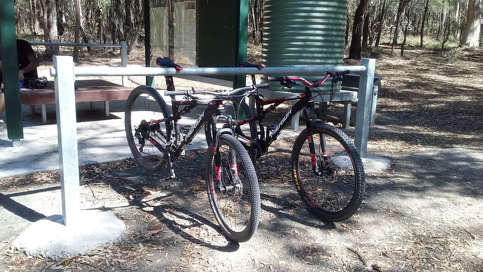
Facilities and amenities - You can find the following facilities at the Days Road entrance and at the southern end of The Maze and Sharks Tail trails:
bike racks
bike repair station
horse hitching rail (on bike rack)
water tank and horse trough
two shelters with maps
seat.
More information and printable maps can be found at the following link:
Story time
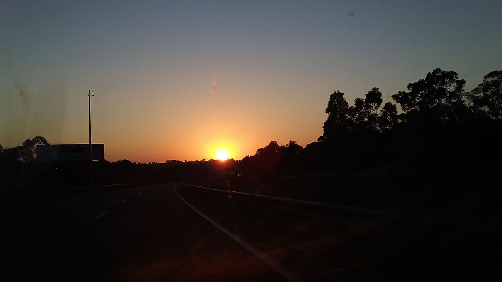
Waking up at the ungodly hour of 04:00 to get ready for the day’s explorations. A quick breakfast of muesli, fresh fruit and an egg, oh, don’t forget the vitamin C-offee, car loaded by 05:30 and on the road to pick up Steven (What a wonderful sunrise along the way, see photos).
We arrived at the Days Road entrance at a little after 06:30, to find the car park full and cars lined up the road. Note to self: park at one of the other entrances next time, Days Road has limited space.
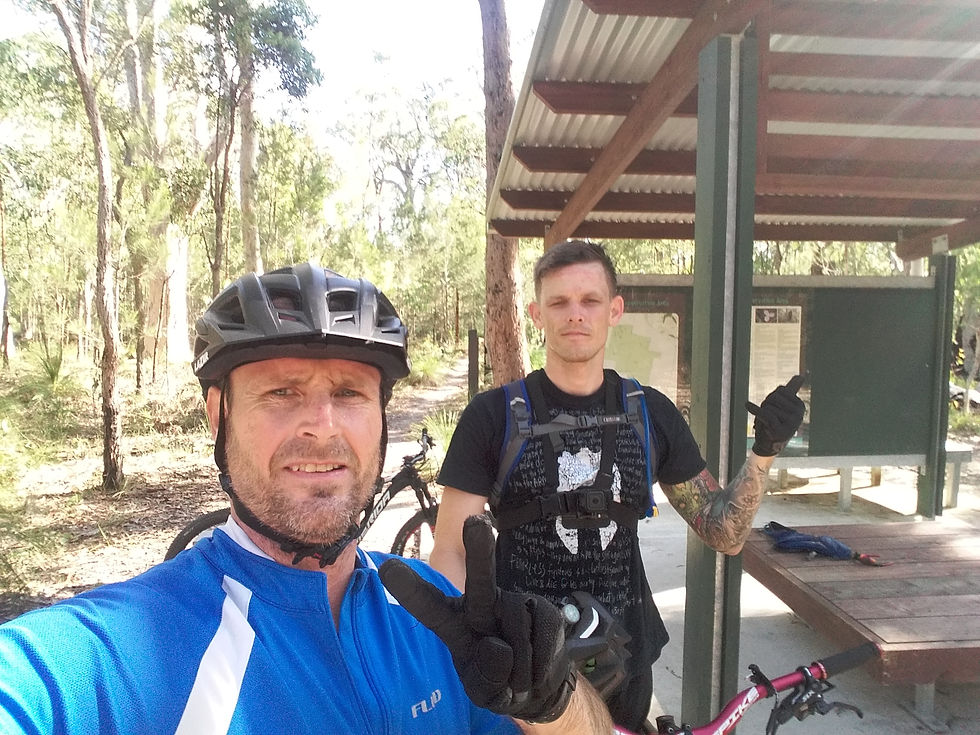
Getting on the roll after taking a photo of the map at one of the shelters, and, given our limited knowledge of this location, making a half-baked route to ride. At the first intersection, our planned route goes out the proverbial (MTBS don’t have windows) window and we begin to follow our noses to wherever they happen to point, ahhhhhh, RIGHT. Turns out we happen to be able to sniff out some pretty awesome trails.
After turning off Puck Road, Vegie-mite trail turns out to be a fun and slightly technical blue climb, just the thing to warm the legs up. Then we followed our noses and found the awesome trail of You’re Kidding, a very tight single track amongst the native grass trees (political correctness does not allow me to name them as I was taught) and pine forest, which goes on forever, approximately 3.5km. This track is relatively flat and feels super-fast given the super tightness.
From there it was onto Birdcage (yes there is a cage), Kodyaknobbies, onto The Maze (my favourite of this bottom section) until the shelter at the junction of The Maze, Native Dog Road and the return trail of Shark’s Tail. After a quick recovery, it was up Shark’s Tail and Candlestick.
Note: This whole southern section is very flat and would suit the non-climbers among us. Days Road Main Track onto You’re kidding, Birdcage, Kodyaknobbies, The Maze, Shark’s Tail and back again. This would be a cushy 15km or so flat ride.
But not us, we like to cry a little. So, we set off back up Mudlark until Sake Road and turned left. From there we turned onto Sock Puppet West and onto the Filling Rattler intersection, where we decided to go UP the hill with the intention of feeling the magic of the Sorceress.
Now, this was not the longest of hill climbs, but, it was bloody steep.
After reaching the top we decided to climb on past Flutter Trail, to the top for said Sorceress. Well this last pincher was a bloody vertical wall, I told myself I did well only having to push the very last section, then watched as two iron men managed to scramble the entire hill, well-done guys, you should have a big S on your shirts.
Anyway, we headed back down Sorceress onto Wolf Peach and back via Puck Road Track.
Well puck me, these last two trails were a delight and worth the effort it took to get to them.
Summary
All up this made for a 22km round circuit without any double backs.
Bayview is a quality outdoor recreational reserve, providing excellent facilities. It’s so well sign-posted, that, if you manage to get lost here, you deserve the Darwin award and the natural selection outcome of being lost in the wilds.
The bottom or southern section is an absolute blast, with what feels like never-ending single tracks and no real hills.
The top north-western corner, however, is not flat. Now we didn’t get to explore all the trails on offer in this section as the heat was starting to pick up. So, another day outing is programmed for the near future.
While the area is relatively small, it is possible to spend an entire day riding these quality trails.
Oh, and I forgot to mention all the groomed trail features such as wooden bridges, technical obstacles and banked corners.
So that about does it for today. Until the next time.
Get out there, get amongst it and get adventuring!

(Ride videos coming soon)
B-Line Bruce Hiscock, 11 February 2018


Comments